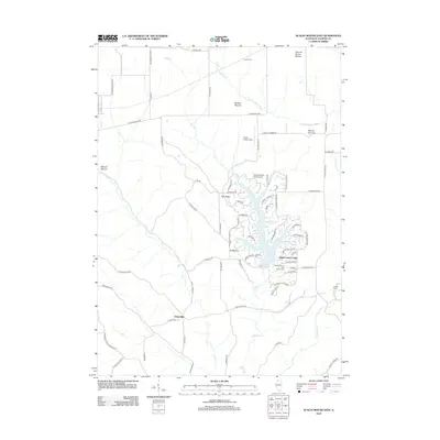
2012 Map of Scales Mound East
USGS Topo · Published 2012About this map
The rolling hills of Jo Daviess County are defined by several prominent rises including Squirrel Grove Mound, Hudson Mound, and Wenzel Mound. This area is dominated by the Apple Canyon Lake development, a significant man-made reservoir surrounded by a dense network of residential roads like Blue Gray Dr and Appromattox Dr. The landscape retains its rural character through the small settlement of Schapville and the agricultural lands bordering the W Fork Apple River. Recreational and utilitarian infrastructure is evident in the Apple Canyon Lake Golf Course and private aviation strips like Foster Field Airport. Farther north, the presence of Laws Siding suggests the area's historical connection to rail-based transport and regional commerce.
Find a feature on this map
76 named features on this map. Tap any name to fly to it.
Don’t see what you’re looking for? This feature index may not catch every label — zoom into the map to look around manually.
Map Details
Editions of this 2012 Scales Mound East Map
This is the sole edition of this map. No revisions or reprints were ever made.
Other maps of this area

1902 · Mineral Point
USGS Topo · 1:125,000

1911 · Elizabeth
USGS Topo · 1:62,500

1911 · Galena
USGS Topo · 1:62,500

1913 · Galena
USGS Topo · 1:62,500

1936 · Elizabeth
USGS Topo · 1:62,500

1952 · Shullsburg
USGS Topo · 1:24,000

1952 · New Diggings
USGS Topo · 1:24,000

1959 · Dubuque
USGS Topo · 1:250,000

1961 · Dubuque
USGS Topo · 1:250,000

1962 · Dubuque
USGS Topo · 1:250,000