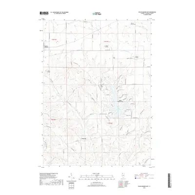
2018 Map of Scales Mound East
USGS Topo · Published 2018About this map
Scales Mound and the surrounding Driftless Area of Northwest Illinois are defined by high-elevation landforms such as Hudson Mound, Squirrel Grove Mound, and Wenzel Mound. This 2018 survey illustrates a landscape of deeply incised valleys and ridge-top roads, where historical routes like E Stagecoach Trl navigate the high ground between the drainage basins of Mill Cr and the W Fork Apple River. The southern portion of the map is dominated by the modern planned community and reservoir of Apple Canyon Lake, which stands in contrast to the traditional rural crossroads of Schapville. Land use patterns here are dictated by the terrain, with agricultural fields occupying the flatter uplands like Pea Ridge and Mound Sumner, while the steep descents toward Hells Br and the Apple River remain largely forested. Local history researchers can trace the modern road network against the underlying township and range system, including t29n r2e and t29n r3e.
Find a feature on this map
73 named features on this map. Tap any name to fly to it.
Don’t see what you’re looking for? This feature index may not catch every label — zoom into the map to look around manually.
Map Details
Editions of this 2018 Scales Mound East Map
This is the sole edition of this map. No revisions or reprints were ever made.
Other maps of this area

1902 · Mineral Point
USGS Topo · 1:125,000

1911 · Elizabeth
USGS Topo · 1:62,500

1911 · Galena
USGS Topo · 1:62,500

1913 · Galena
USGS Topo · 1:62,500

1936 · Elizabeth
USGS Topo · 1:62,500

1952 · Shullsburg
USGS Topo · 1:24,000

1952 · New Diggings
USGS Topo · 1:24,000

1959 · Dubuque
USGS Topo · 1:250,000

1961 · Dubuque
USGS Topo · 1:250,000

1962 · Dubuque
USGS Topo · 1:250,000