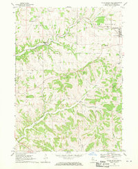
1968 Map of Scales Mound West
USGS Topo · Published 1970About this map
Scales Mound and the surrounding township of Council Hill are defined by a network of steep-cut valleys and upland ridges in this late 1960s survey. The Illinois Central railroad is the primary industrial corridor, following the winding East Fork and connecting Council Hill Station to the village of Scales Mound. The landscape is dotted with small-scale agricultural indicators and several quarries, reflecting the area's geological history.
Find a feature on this map
28 named features on this map. Tap any name to fly to it.
Don’t see what you’re looking for? This feature index may not catch every label — zoom into the map to look around manually.
Map Details
Editions of this 1968 Scales Mound West Map
This is the sole edition of this map. No revisions or reprints were ever made.
Other maps of this area

1902 · Mineral Point
USGS Topo · 1:125,000

1911 · Elizabeth
USGS Topo · 1:62,500

1911 · Galena
USGS Topo · 1:62,500

1913 · Galena
USGS Topo · 1:62,500

1936 · Elizabeth
USGS Topo · 1:62,500

1952 · Shullsburg
USGS Topo · 1:24,000

1952 · Cuba City
USGS Topo · 1:24,000

1952 · New Diggings
USGS Topo · 1:24,000

1959 · Dubuque
USGS Topo · 1:250,000

1961 · Dubuque
USGS Topo · 1:250,000