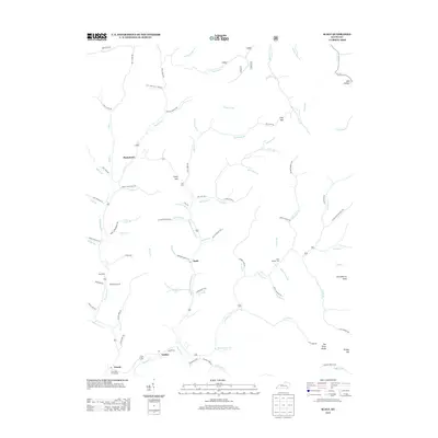
2013 Map of Scalf
USGS Topo · Published 2013About this map
Stinking Creek and its complex network of tributaries, including Middle Fork Stinking Creek and Tuggle Fork, define the settlement patterns of this Knox County landscape. The community of Scalf serves as a central point for the surrounding hollows, while the southern reaches of the map show the confluence at The Forks of Stinking near the settlement of Dewitt. This area is characterized by high ridges and gaps, such as Clay Gap and Caney Gap, which historically dictated the placement of roads like Jones Fork Road and Walker Road.
Find a feature on this map
96 named features on this map. Tap any name to fly to it.
Don’t see what you’re looking for? This feature index may not catch every label — zoom into the map to look around manually.
Map Details
Editions of this 2013 Scalf Map
This is the sole edition of this map. No revisions or reprints were ever made.
Other maps of this area

1886 · Cumberland Gap
USGS Topo · 1:125,000

1888 · Cumberland Gap
USGS Topo · 1:125,000

1891 · Manchester
USGS Topo · 1:125,000

1891 · Cumberland Gap
USGS Topo · 1:125,000

1903 · Pineville
USGS Topo · 1:48,000

1952 · Hima
USGS Topo · 1:24,000

1952 · Fount
USGS Topo · 1:24,000
1952 · Artemus
USGS Topo · 1:24,000
1954 · Ogle
USGS Topo · 1:24,000
1954 · Pineville
USGS Topo · 1:24,000