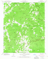
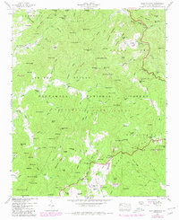
1946 Map of Scaly Mountain
USGS Topo · Published 1967About this map
Nantahala National Forest dominates this topographic study of the Blue Ridge terrain, where isolated settlements like Tumblerville and Happy Hill are tucked between steep ridges and deep coves. The 1946 field examination reveals a landscape defined by water power and timber, with Middle Creek Mill and Watkins Mill serving the local communities. The settlement pattern follows the drainage of the Cullasaja River and Tessentee Creek, with family-centered landmarks such as Stiles Cem and Miller Cem providing vital points of reference for genealogists. The presence of Gold Mine and Gold Mine Cem near California Gap points to the region's mineral history, while the Blue Ridge Divide separates the Tennessee valley waters from those flowing toward the Atlantic. This area, spanning the Smith Bridge and Sugar Fork districts, maintains the character of a highland frontier centered around the Scaly Sch and rural churches like Drymans Chapel.
Find a feature on this map
139 named features on this map. Tap any name to fly to it.
Don’t see what you’re looking for? This feature index may not catch every label — zoom into the map to look around manually.
Map Details
Editions of this 1946 Scaly Mountain Map
5 editions found
Other maps of this area

1886 · Walhalla
USGS Topo · 1:125,000

1891 · Cowee
USGS Topo · 1:125,000

1892 · Walhalla
USGS Topo · 1:125,000

1896 · Walhalla
USGS Topo · 1:125,000

1897 · Cowee
USGS Topo · 1:125,000

1907 · Cowee
USGS Topo · 1:125,000

1935 · Franklin
USGS Topo · 1:24,000

1935 · Prentiss
USGS Topo · 1:24,000

1935 · Dillard
USGS Topo · 1:24,000

1935 · Scaly
USGS Topo · 1:24,000