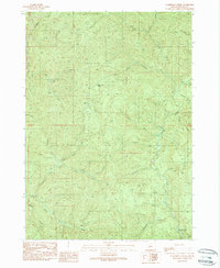
1989 Map of Scaredman Creek
USGS Topo · Published 1990About this map
Canton Creek and Rock Creek dominate the drainage patterns of this Douglas County landscape in the late 1980s. The area is defined by its complex network of named waterways, including the Northeast Fork Rock Creek and Huckleberry Creek, which carve through the high terrain of Mace and Wapiti. This provisional survey reflects a period of active resource management and early recreational development, anchored by the Scaredman Creek Recreation Site in the southern portion of the quadrangle. Small-scale industrial activity is evident in several Quarry and Borrow Pit locations, while topographic landmarks like Mellow Moon and its associated Mellow Moon Spring provide points of reference. The map documents an extensive network of unimproved roads and four-wheel-drive trails, illustrating the accessibility of these timberlands for both forestry and public recreation.
Find a feature on this map
35 named features on this map. Tap any name to fly to it.
Don’t see what you’re looking for? This feature index may not catch every label — zoom into the map to look around manually.
Map Details
Editions of this 1989 Scaredman Creek Map
This is the sole edition of this map. No revisions or reprints were ever made.
Other maps of this area

1935 · Lowell
USGS Topo · 1:96,000

1942 · Lowell
USGS Topo · 1:125,000

1955 · Mace Mtn
USGS Topo · 1:62,500

1955 · Illahee Rock
USGS Topo · 1:62,500

1955 · Fairview Peak
USGS Topo · 1:62,500

1955 · Culp Creek
USGS Topo · 1:62,500

1958 · Roseburg
USGS Topo · 1:250,000

1959 · Roseburg
USGS Topo · 1:250,000

1978 · Diamond Lake
USGS Topo · 1:100,000

1983 · Oakridge
USGS Topo · 1:100,000