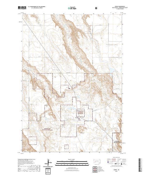
2021 Map of Scenic
USGS Topo · Published 2021About this map
Scenic stands at a geological crossroads where the high mesas of the western plains meet the intricate erosion of the badlands. This area is characterized by high, flat-topped landforms known as tables, including Kube Table, Seventyone Table, and Hart Table, which drop sharply into the Scenic Basin. The settlement is closely bordered by the vast reaches of the Buffalo Gap National Grassland, with the southeastern corner of the map capturing the edge of Badlands National Park. The landscape is etched by drainage networks like Bear Creek, Spring Draw, and Farnum Draw, which have carved deep paths through the local topography. This map documents the area's rural character, centering on the small community and the Scenic Cem while illustrating the sparse, section-line road network that serves this part of Pennington County.
Find a feature on this map
28 named features on this map. Tap any name to fly to it.
Don’t see what you’re looking for? This feature index may not catch every label — zoom into the map to look around manually.
Map Details
Editions of this 2021 Scenic Map
This is the sole edition of this map. No revisions or reprints were ever made.
Other maps of this area

1950 · Sheep Mountain Table
USGS Topo · 1:24,000

1950 · Imlay
USGS Topo · 1:24,000

1951 · Heutmacher Table
USGS Topo · 1:24,000

1954 · Scenic
USGS Topo · 1:24,000

1954 · Creston
USGS Topo · 1:24,000

1954 · Scenic SW
USGS Topo · 1:24,000

1954 · Brennan Flat
USGS Topo · 1:24,000

1954 · Quinn Table
USGS Topo · 1:24,000

1955 · Hot Springs
USGS Topo · 1:250,000
1960 · Quinn Table SW
USGS Topo · 1:24,000