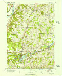
1954 Map of Schaghticoke
USGS Topo · Published 1956About this map
Industrial and agricultural life along the Hoosic River defines this mid-century portrait of Rensselaer and Washington Counties. The village of Schaghticoke and nearby Valley Falls are central hubs of activity, anchored by the Boston and Maine Railroad and the local Hydroelectric Station. To the north, the Old Champlain Canal sits in a state of disuse near the boundary of Saratoga National Historical Park, marking a shift in regional transportation from water to rail.
Find a feature on this map
37 named features on this map. Tap any name to fly to it.
Don’t see what you’re looking for? This feature index may not catch every label — zoom into the map to look around manually.
Map Details
Editions of this 1954 Schaghticoke Map
4 editions found
Other maps of this area

1893 · Cohoes
USGS Topo · 1:62,500

1895 · Cohoes
USGS Topo · 1:62,500

1895 · Cambridge
USGS Topo · 1:62,500

1897 · Hoosick
USGS Topo · 1:62,500

1898 · Cambridge
USGS Topo · 1:62,500

1898 · Cohoes
USGS Topo · 1:62,500

1900 · Taconic
USGS Topo · 1:125,000

1900 · Schuylerville
USGS Topo · 1:62,500

1901 · Cambridge
USGS Topo · 1:62,500

1903 · Mettawee
USGS Topo · 1:125,000