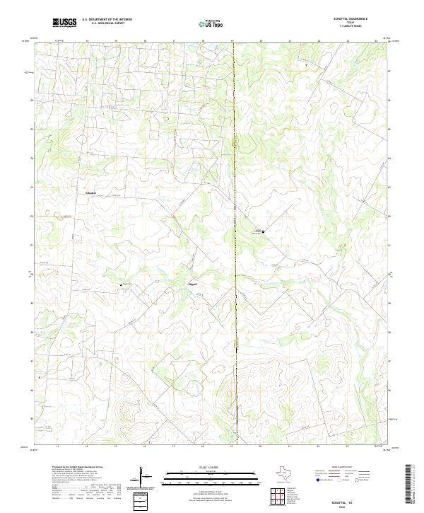
2022 Map of Schattel
USGS Topo · Published 2022About this map
Schattel and Miguel anchor this rural landscape in the brush country of South Texas, where ranching and local family histories intersect at the Frio and Atascosa county line. The terrain is defined by an intricate network of intermittent drainage, including the winding Lagunillas Cr and the waters of Kyote Lake to the north. Several family-named landmarks provide significant value for genealogists, most notably the Adolph Cumpian Family Cem situated near Ellis Br and the Miguel Cem located just west of the Miguel settlement.
Find a feature on this map
42 named features on this map. Tap any name to fly to it.
Don’t see what you’re looking for? This feature index may not catch every label — zoom into the map to look around manually.
Map Details
Editions of this 2022 Schattel Map
This is the sole edition of this map. No revisions or reprints were ever made.
Other maps of this area

1934 · Schattel
USGS Topo · 1:62,500

1942 · Natalia
USGS Topo · 1:62,500

1953 · Crystal City
USGS Topo · 1:250,000

1954 · San Antonio
USGS Topo · 1:250,000

1955 · Crystal City
USGS Topo · 1:250,000

1956 · Jourdanton
USGS Topo · 1:62,500

1957 · San Antonio
USGS Topo · 1:250,000

1961 · Crystal City
USGS Topo · 1:250,000

1964 · Ghost Hill
USGS Topo · 1:24,000
1964 · Bigfoot
USGS Topo · 1:24,000