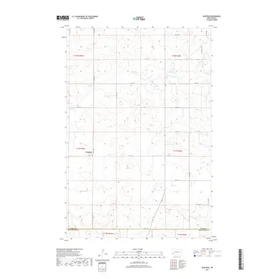
2017 Map of Schefield
USGS Topo · Published 2017About this map
Schefield sits at a remote prairie intersection in the southwestern North Dakota highlands, where the grid-iron road system of Stark and Hettinger Counties dictates the landscape. This 2017 study illustrates a region defined by its agricultural geometry, with section-line roads like Main S and 115th Ave SW connecting isolated farmsteads across the high plains. The drainage of Antelope Creek provides the primary topographic variation, carving shallow draws through the nearly 2,800-foot elevations of the surrounding terrain. Land use here is strictly divided by the Public Land Survey System, as evidenced by the clear township boundaries such as t137n r97w and t137n r96w. The map provides a precise view of the rural infrastructure, from the southern boundary at 54th St SW to the various unnamed structures that comprise the small community of Schefield.
Find a feature on this map
24 named features on this map. Tap any name to fly to it.
Don’t see what you’re looking for? This feature index may not catch every label — zoom into the map to look around manually.
Map Details
Editions of this 2017 Schefield Map
This is the sole edition of this map. No revisions or reprints were ever made.
Other maps of this area

1953 · Dickinson
USGS Topo · 1:250,000

1957 · Dickinson
USGS Topo · 1:250,000

1959 · Dickinson South
USGS Topo · 1:24,000

1959 · Lehigh
USGS Topo · 1:24,000

1973 · Lefor NW
USGS Topo · 1:24,000

1973 · New England NW
USGS Topo · 1:24,000

1973 · New England
USGS Topo · 1:24,000

1973 · Lefor SW
USGS Topo · 1:24,000

1973 · Schefield
USGS Topo · 1:24,000

1973 · New England SW
USGS Topo · 1:24,000