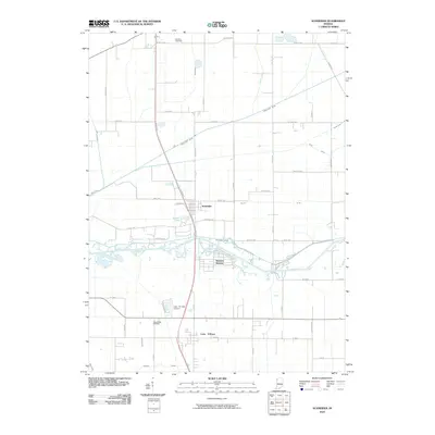
2010 Map of Schneider
USGS Topo · Published 2010About this map
The Kankakee River winds through this landscape, defining the character of southern Lake County. The town of Schneider and the community of Sumava Resorts are positioned along the river's northern banks, illustrating the area's history as a destination for recreation and river-adjacent living. To the south, the settlement of Lake Village serves as a local hub, supported by the Lake Village Airport and the nearby Lake Village Cemetery.
Find a feature on this map
55 named features on this map. Tap any name to fly to it.
Don’t see what you’re looking for? This feature index may not catch every label — zoom into the map to look around manually.
Map Details
Editions of this 2010 Schneider Map
This is the sole edition of this map. No revisions or reprints were ever made.
Other maps of this area

1922 · Momence
USGS Topo · 1:62,500

1924 · Momence
USGS Topo · 1:62,500

1949 · Crete
USGS Topo · 1:62,500

1953 · Leroy
USGS Topo · 1:24,000

1953 · Beecher East
USGS Topo · 1:24,000

1953 · Lowell
USGS Topo · 1:24,000

1953 · Chicago
USGS Topo · 1:250,000

1957 · Chicago
USGS Topo · 1:250,000

1959 · Schneider
USGS Topo · 1:24,000

1959 · Shelby
USGS Topo · 1:24,000