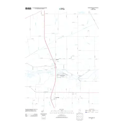
2013 Map of Schneider
USGS Topo · Published 2013About this map
The Kankakee River winds through this Northwest Indiana landscape, defining the boundary between Lake and Newton counties. In the early 21st century, the area remains dominated by an extensive network of drainage infrastructure, with Singleton Ditch, Beaver Lake Ditch, and Williams Ditch illustrating the long-standing efforts to manage the marshy terrain of the Grand Kankakee Marsh. The small settlements of Schneider and Sumava Resorts sit just north of the river, while Lake Village lies to the south near the Lake Village Airport. Local transportation is anchored by the north-south corridor of US 41, crossing paths with the historical alignment of Monon Rd, reflecting the region's transition from a rail-dependent frontier to a motorized rural economy. The grid-like arrangement of secondary roads like W 205th Ave and W 231st Ave further emphasizes the agricultural reclamation of this once-saturated basin.
Find a feature on this map
86 named features on this map. Tap any name to fly to it.
Don’t see what you’re looking for? This feature index may not catch every label — zoom into the map to look around manually.
Map Details
Editions of this 2013 Schneider Map
This is the sole edition of this map. No revisions or reprints were ever made.
Other maps of this area

1922 · Momence
USGS Topo · 1:62,500

1924 · Momence
USGS Topo · 1:62,500

1949 · Crete
USGS Topo · 1:62,500

1953 · Leroy
USGS Topo · 1:24,000

1953 · Beecher East
USGS Topo · 1:24,000

1953 · Lowell
USGS Topo · 1:24,000

1953 · Chicago
USGS Topo · 1:250,000

1957 · Chicago
USGS Topo · 1:250,000

1959 · Schneider
USGS Topo · 1:24,000

1959 · Shelby
USGS Topo · 1:24,000