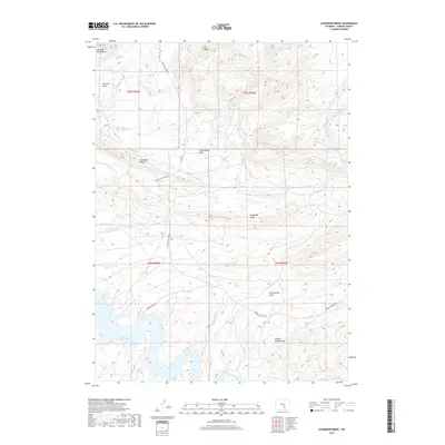
2017 Map of Schneider Ridge
USGS Topo · Published 2017About this map
The Seminoe Reservoir dominates the southwestern corner of this Carbon County landscape, where the waters meet the high elevations of the Seminoe Mountains. This high-desert terrain is defined by a series of named drainages and topographic features that speak to the region's ranching and transit history, such as Schoolhouse Draw and the family-named Charlie Brooks Draw. The network of intermittent streams, including Caton Cr and Austin Cr, flows toward the reservoir and the Medicine Bow River at the southern boundary. Transportation through this part of the Wyoming interior relies on the Hanna Leo Draw Rd and Co RD 291, which navigate the elevation changes between Schneider Ridge and Horseshoe Ridge. The presence of Tennant Spring and various draws like Cottonwood Draw indicates the critical importance of water management in this arid environment.
Find a feature on this map
29 named features on this map. Tap any name to fly to it.
Don’t see what you’re looking for? This feature index may not catch every label — zoom into the map to look around manually.
Map Details
Editions of this 2017 Schneider Ridge Map
This is the sole edition of this map. No revisions or reprints were ever made.
Other maps of this area

1893 · Fort Steele
USGS Topo · 1:125,000

1914 · Hanna
USGS Topo · 1:62,500

1914 · Walcott
USGS Topo · 1:62,500

1953 · Seminoe Dam NE
USGS Topo · 1:24,000

1953 · Seminoe Dam SE
USGS Topo · 1:24,000

1953 · Schneider Ridge
USGS Topo · 1:24,000

1953 · The Q Ranch
USGS Topo · 1:24,000

1953 · T E Ranch
USGS Topo · 1:24,000

1953 · Beaver Creek
USGS Topo · 1:24,000

1954 · Rawlins
USGS Topo · 1:250,000