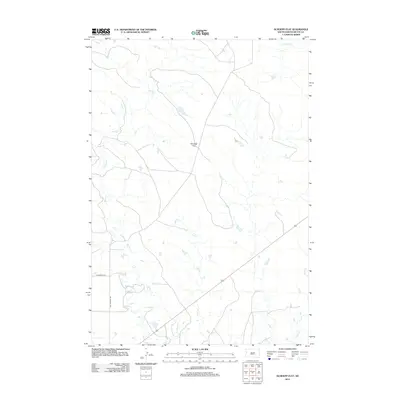
2012 Map of Schoepp Flat
USGS Topo · Published 2012About this map
Schoepp Flat dominates this high plains landscape of Butte County, where the terrain is defined by a dendritic network of intermittent watercourses. Drainage patterns include the winding Willow Cr and Sand Ct, which flow alongside smaller tributaries such as S Double R Cr and Butte Cr. The presence of the North Lateral canal suggests the management of water for agricultural or ranching purposes in an otherwise arid environment. Settlement is sparse, with human activity primarily represented by rural corridors like Old Twilight Rd and Falzerano Rd. This 2012 survey illustrates the modern ranching character of the region, where wide-open rangeland is punctuated by local roads and vital creek beds.
Find a feature on this map
8 named features on this map. Tap any name to fly to it.
Don’t see what you’re looking for? This feature index may not catch every label — zoom into the map to look around manually.
Map Details
Editions of this 2012 Schoepp Flat Map
This is the sole edition of this map. No revisions or reprints were ever made.
Other maps of this area

1906 · Vale
USGS Topo · 1:62,500

1913 · Newell
USGS Topo · 1:125,000

1951 · Newell
USGS Topo · 1:24,000

1951 · Vale NE
USGS Topo · 1:24,000

1951 · Vale
USGS Topo · 1:62,500

1953 · Rapid City
USGS Topo · 1:250,000

1957 · Rapid City
USGS Topo · 1:250,000
1959 · Volunteer NW
USGS Topo · 1:24,000
1973 · Owl Butte
USGS Topo · 1:24,000
1977 · Castle Rock
USGS Topo · 1:24,000