
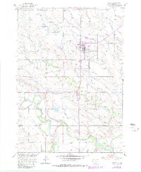
1951 Map of Newell
USGS Topo · Published 1953About this map
The Newell Experiment Station sits at the heart of this Western South Dakota landscape, illustrating the mid-century intersection of agricultural research and irrigation engineering. The town of Newell serves as the primary hub, surrounded by an intricate network of water management features including the Wolf Canal, the Town Site Lateral, and various levees that channel water toward the surrounding ranching and farming operations. The Chicago and North Western railway cuts through the southern terrain, connecting the cattle-loading area at Morsman Siding to the regional market.
Find a feature on this map
33 named features on this map. Tap any name to fly to it.
Don’t see what you’re looking for? This feature index may not catch every label — zoom into the map to look around manually.
Map Details
Editions of this 1951 Newell Map
2 editions found
Other maps of this area

1905 · Saint Onge
USGS Topo · 1:62,500

1906 · Two Top
USGS Topo · 1:62,500

1906 · Vale
USGS Topo · 1:62,500

1907 · Belle Fourche
USGS Topo · 1:125,000

1913 · Newell
USGS Topo · 1:125,000

1951 · Vale
USGS Topo · 1:24,000

1951 · Vale SE
USGS Topo · 1:24,000

1951 · Vale NE
USGS Topo · 1:24,000
1951 · Nisland
USGS Topo · 1:24,000

1951 · Vale
USGS Topo · 1:62,500