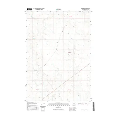
2015 Map of Schoepp Flat
USGS Topo · Published 2015About this map
Schoepp Flat serves as the central topographic feature of this Butte County landscape, characterized by a series of drainages and ranch roads during the mid-2010s. The hydrology is defined by the winding paths of Willow Cr and Jug Cr, which carve through the open terrain alongside smaller tributaries like Sand Cr and S Double R Cr. These watercourses reveal the natural drainage patterns that have historically shaped land use in this part of South Dakota.
Find a feature on this map
17 named features on this map. Tap any name to fly to it.
Don’t see what you’re looking for? This feature index may not catch every label — zoom into the map to look around manually.
Map Details
Editions of this 2015 Schoepp Flat Map
This is the sole edition of this map. No revisions or reprints were ever made.
Other maps of this area

1906 · Vale
USGS Topo · 1:62,500

1913 · Newell
USGS Topo · 1:125,000

1951 · Newell
USGS Topo · 1:24,000

1951 · Vale NE
USGS Topo · 1:24,000

1951 · Vale
USGS Topo · 1:62,500

1953 · Rapid City
USGS Topo · 1:250,000

1957 · Rapid City
USGS Topo · 1:250,000
1959 · Volunteer NW
USGS Topo · 1:24,000
1973 · Owl Butte
USGS Topo · 1:24,000
1977 · Castle Rock
USGS Topo · 1:24,000