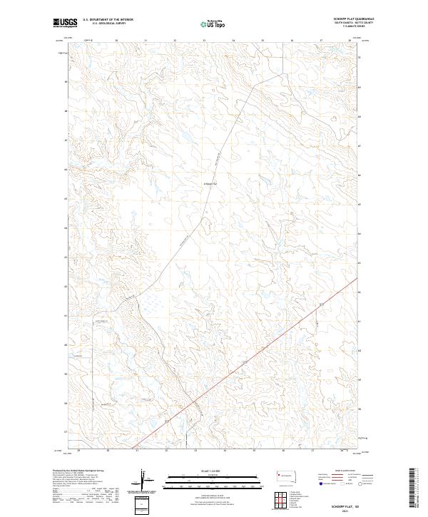
2021 Map of Schoepp Flat
USGS Topo · Published 2021About this map
Schoepp Flat dominates this high plains landscape in Butte County, where a network of seasonal drainages and local roads defines the modern rural character. The terrain is marked by the meandering paths of Willow Cr, Jug Cr, and Sand Cr, which cut through the open country. Early twenty-first-century infrastructure is evidenced by the intersection of Old Twilight Rd and Twilight Rd, alongside more specific local thoroughfares such as Knutson Cut-Off Rd and Paint Horse Ln. Irrigation and water management are subtly indicated by the N Lateral canal in the southwestern portion of the sheet. This survey provides a clear look at the large-scale ranching and land division patterns, with sections clearly defined by the Public Land Survey System reaching into the northern and southern townships.
Find a feature on this map
20 named features on this map. Tap any name to fly to it.
Don’t see what you’re looking for? This feature index may not catch every label — zoom into the map to look around manually.
Map Details
Editions of this 2021 Schoepp Flat Map
This is the sole edition of this map. No revisions or reprints were ever made.
Other maps of this area

1906 · Vale
USGS Topo · 1:62,500

1913 · Newell
USGS Topo · 1:125,000

1951 · Newell
USGS Topo · 1:24,000

1951 · Vale NE
USGS Topo · 1:24,000

1951 · Vale
USGS Topo · 1:62,500

1953 · Rapid City
USGS Topo · 1:250,000

1957 · Rapid City
USGS Topo · 1:250,000
1959 · Volunteer NW
USGS Topo · 1:24,000
1973 · Owl Butte
USGS Topo · 1:24,000
1977 · Castle Rock
USGS Topo · 1:24,000