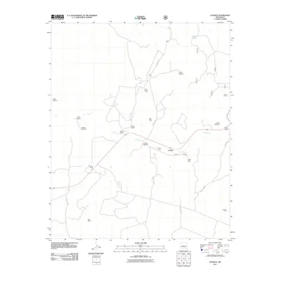
2011 Map of Scholle
USGS Topo · Published 2011About this map
Scholle sits at a historic crossroads where the drainage of the Abo Arroyo carves through the landscape of Torrance County. The map reveals a legacy of resource extraction, centered around mining operations like the Scholle Plant Mine, Abo Mine, and the Gabaldon Mine. These sites, along with the Scholle Claim Group and Jack Rabbit Claim, suggest a period of intense geological interest in the local ores.
Find a feature on this map
26 named features on this map. Tap any name to fly to it.
Don’t see what you’re looking for? This feature index may not catch every label — zoom into the map to look around manually.
Map Details
Editions of this 2011 Scholle Map
This is the sole edition of this map. No revisions or reprints were ever made.
Other maps of this area

1916 · La Joya
USGS Topo · 1:125,000

1917 · Estancia
USGS Topo · 1:125,000

1952 · Tome SE
USGS Topo · 1:24,000

1952 · Becker
USGS Topo · 1:24,000

1952 · Cerro Montoso
USGS Topo · 1:24,000

1954 · Torreon
USGS Topo · 1:62,500

1954 · Socorro
USGS Topo · 1:250,000

1958 · Socorro
USGS Topo · 1:250,000

1962 · Socorro
USGS Topo · 1:250,000

1972 · Chupadera
USGS Topo · 1:24,000