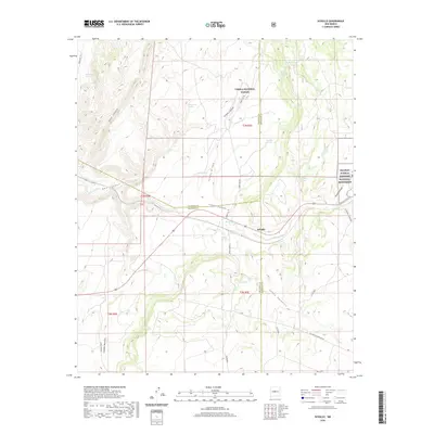
2020 Map of Scholle
USGS Topo · Published 2020About this map
Scholle sits at the intersection of high-desert drainage systems and modern infrastructure in this Central New Mexico landscape. The settlement is defined by its proximity to Abo Arroyo, a primary waterway that carves through the terrain alongside significant archaeological and natural preserves. Portions of the Salinas Pueblo Missions National Monument and the Cibola National Forest are documented here, highlighting the convergence of federal land management and historical sites.
Find a feature on this map
39 named features on this map. Tap any name to fly to it.
Don’t see what you’re looking for? This feature index may not catch every label — zoom into the map to look around manually.
Map Details
Editions of this 2020 Scholle Map
This is the sole edition of this map. No revisions or reprints were ever made.
Other maps of this area

1916 · La Joya
USGS Topo · 1:125,000

1917 · Estancia
USGS Topo · 1:125,000

1952 · Tome SE
USGS Topo · 1:24,000

1952 · Becker
USGS Topo · 1:24,000

1952 · Cerro Montoso
USGS Topo · 1:24,000

1954 · Torreon
USGS Topo · 1:62,500

1954 · Socorro
USGS Topo · 1:250,000

1958 · Socorro
USGS Topo · 1:250,000

1962 · Socorro
USGS Topo · 1:250,000

1972 · Chupadera
USGS Topo · 1:24,000