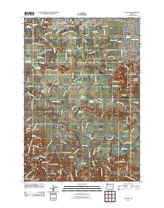
2011 Map of Scholls
USGS Topo · Published 2011About this map
The Tualatin River meanders through this portion of the Tualatin Valley, defining a landscape where historic crossings like Harris Bridge, Rood Bridge, and Scholls Bridge once anchored the local transport network. This 2011 survey captures the transition from the agriculture of Farmington and Scholls to the residential growth spreading near Hazeldale and Reedville. Genealogists will find a high density of burial sites, including Saint Matthews Cemetery, Lewis Cemetery, and Mountainside Cemetery. The map also reflects the local aviation and leisure culture, noted by Pats Pasture Airstrip, Starks Twin Oaks Airpark, and the Meriwether Golf Course. From the low-lying Jackson Bottom to the rising terrain of Cooper Mountain, the map documents the complex water management systems of the era, visible in the Rock Creek Advanced Wastewater Treatment Facility and numerous reservoirs.
Find a feature on this map
107 named features on this map. Tap any name to fly to it.
Don’t see what you’re looking for? This feature index may not catch every label — zoom into the map to look around manually.
Map Details
Editions of this 2011 Scholls Map
This is the sole edition of this map. No revisions or reprints were ever made.
Other maps of this area

1915 · Hillsboro
USGS Topo · 1:62,500

1916 · Tualatin
USGS Topo · 1:62,500

1918 · Hillsboro
USGS Topo · 1:62,500

1939 · Tualatin
USGS Topo · 1:62,500

1940 · Tualatin
USGS Topo · 1:62,500

1940 · Hillsboro
USGS Topo · 1:62,500

1941 · Gales Creek
USGS Topo · 1:62,500

1941 · Yamhill
USGS Topo · 1:62,500

1942 · Yamhill
USGS Topo · 1:62,500

1948 · Vancouver
USGS Topo · 1:250,000