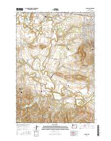
2017 Map of Scholls
USGS Topo · Published 2017About this map
The Tualatin River meanders through the heart of this Washington County landscape, defining the boundaries of agricultural and residential life south of Hillsboro. The terrain transitions from the low-lying Jackson Bottom to the rising slopes of the Chehalem Mountains and Laurel Ridge. The infrastructure of the area is anchored by several river crossings, including Rood Bridge and Scholls Bridge, which connect small communities like Scholls, Midway, and Farmington.
Find a feature on this map
111 named features on this map. Tap any name to fly to it.
Don’t see what you’re looking for? This feature index may not catch every label — zoom into the map to look around manually.
Map Details
Editions of this 2017 Scholls Map
This is the sole edition of this map. No revisions or reprints were ever made.
Other maps of this area

1915 · Hillsboro
USGS Topo · 1:62,500

1916 · Tualatin
USGS Topo · 1:62,500

1918 · Hillsboro
USGS Topo · 1:62,500

1939 · Tualatin
USGS Topo · 1:62,500

1940 · Tualatin
USGS Topo · 1:62,500

1940 · Hillsboro
USGS Topo · 1:62,500

1941 · Gales Creek
USGS Topo · 1:62,500

1941 · Yamhill
USGS Topo · 1:62,500

1942 · Yamhill
USGS Topo · 1:62,500

1948 · Vancouver
USGS Topo · 1:250,000