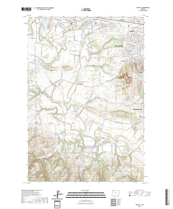
2024 Map of Scholls
USGS Topo · Published 2024About this map
Hillsboro and the surrounding Tualatin Valley are presented in this contemporary topographic record, showing the dense network of agricultural and suburban development near Beaverton. The landscape is defined by the winding course of the Tualatin River, which feeds numerous irrigation sites including Ettinger Reservoir and Wandell Reservoir. For genealogists and local historians, several burial grounds are documented, such as Saint Matthews Catholic Cem and Mount Olive Cem of Laurel, serving as important identifiers for early community centers like Scholls, Midway, and Witch Hazel.
Find a feature on this map
109 named features on this map. Tap any name to fly to it.
Don’t see what you’re looking for? This feature index may not catch every label — zoom into the map to look around manually.
Map Details
Editions of this 2024 Scholls Map
This is the sole edition of this map. No revisions or reprints were ever made.
Other maps of this area

1915 · Hillsboro
USGS Topo · 1:62,500

1916 · Tualatin
USGS Topo · 1:62,500

1918 · Hillsboro
USGS Topo · 1:62,500

1939 · Tualatin
USGS Topo · 1:62,500

1940 · Tualatin
USGS Topo · 1:62,500

1940 · Hillsboro
USGS Topo · 1:62,500

1941 · Gales Creek
USGS Topo · 1:62,500

1941 · Yamhill
USGS Topo · 1:62,500

1942 · Yamhill
USGS Topo · 1:62,500

1948 · Vancouver
USGS Topo · 1:250,000