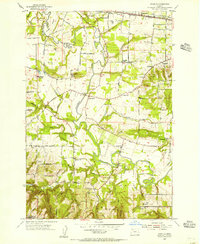
1954 Map of Scholls
USGS Topo · Published 1956About this map
The Tualatin River snakes through the center of this mid-century landscape, defining the agricultural and social geography of Washington County. Small unincorporated communities like Scholls, Farmington, and Reedville serve as focal points for a network of rural roads such as Ferry Road and Rosedale Road. The map reveals a transition in local education, documenting several shuttered institutions including Farmington School (Aban'd), Midway Sch (Aban'd), and Laurel Ridge Sch (Aban'd).
Find a feature on this map
56 named features on this map. Tap any name to fly to it.
Don’t see what you’re looking for? This feature index may not catch every label — zoom into the map to look around manually.
Map Details
Editions of this 1954 Scholls Map
This is the sole edition of this map. No revisions or reprints were ever made.
Other maps of this area

1915 · Hillsboro
USGS Topo · 1:62,500

1916 · Tualatin
USGS Topo · 1:62,500

1918 · Hillsboro
USGS Topo · 1:62,500

1939 · Tualatin
USGS Topo · 1:62,500

1940 · Tualatin
USGS Topo · 1:62,500

1940 · Hillsboro
USGS Topo · 1:62,500

1941 · Gales Creek
USGS Topo · 1:62,500

1941 · Yamhill
USGS Topo · 1:62,500

1942 · Yamhill
USGS Topo · 1:62,500

1948 · Vancouver
USGS Topo · 1:250,000