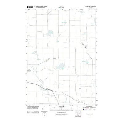
2010 Map of School Hill
USGS Topo · Published 2010About this map
The Sheboygan River and Pigeon River define the hydraulic character of this Manitowoc County landscape, where small crossroads communities like School Hill and Louis Corners anchor a grid of rural roads. The map reveals a high density of small lakes, including the cluster of Shoe Lake, Graf Lake, and Prueder Lake in the west, and the central Cedar Lake. Historical industry is grounded in water power at the Rockville Dam and Millhome Dam, reflecting a heritage of river-reliant settlement. For genealogists, the map is particularly useful for locating community centers such as Ada and Millhome, alongside several well-marked burial grounds including Holy Trinity Cemetery, Union Cemetery, and Bethel Cemetery. The persistence of family-named landmarks like Eaton Twin Lakes and Wilke Lake suggests deep generational ties to these specific parcels and waterways.
Find a feature on this map
72 named features on this map. Tap any name to fly to it.
Don’t see what you’re looking for? This feature index may not catch every label — zoom into the map to look around manually.
Map Details
Editions of this 2010 School Hill Map
This is the sole edition of this map. No revisions or reprints were ever made.
Other maps of this area

1954 · School Hill
USGS Topo · 1:24,000

1954 · St. Wendel
USGS Topo · 1:24,000

1954 · Howards Grove
USGS Topo · 1:62,500

1954 · Howards Grove
USGS Topo · 1:24,000

1954 · Chilton
USGS Topo · 1:62,500

1954 · Reedsville
USGS Topo · 1:62,500

1954 · Franklin
USGS Topo · 1:24,000

1954 · Kiel
USGS Topo · 1:62,500

1954 · Milwaukee
USGS Topo · 1:250,000

1954 · Manitowoc
USGS Topo · 1:250,000