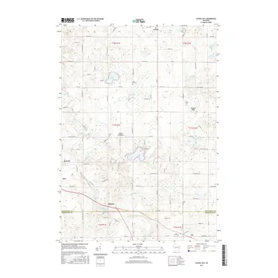
2016 Map of School Hill
USGS Topo · Published 2016About this map
The Sheboygan River and Pigeon River snake through this landscape of the mid-2010s, defining a region where glacial lakes and small agricultural hamlets dominate the terrain. Significant water bodies like Cedar Lake, Wilke Lake, and Eaton Twin Lakes are central features, likely serving as local hubs for recreation and environmental preservation. The map documents the persistent layout of unincorporated communities such as School Hill, Louis Corners, and Millhome, providing a clear view of the rural road network connecting these settlements. For genealogists, the placement of several burial grounds, including Holy Trinity Cem, Loreto Cem, and Saint Johns Cem, offers precise locations for ancestral research. The transition between Manitowoc and Sheboygan counties is clearly marked near the city of Kiel, showing the intersection of political boundaries and natural waterways like the Millhome Flowage.
Find a feature on this map
75 named features on this map. Tap any name to fly to it.
Don’t see what you’re looking for? This feature index may not catch every label — zoom into the map to look around manually.
Map Details
Editions of this 2016 School Hill Map
This is the sole edition of this map. No revisions or reprints were ever made.
Other maps of this area

1954 · School Hill
USGS Topo · 1:24,000

1954 · St. Wendel
USGS Topo · 1:24,000

1954 · Howards Grove
USGS Topo · 1:62,500

1954 · Howards Grove
USGS Topo · 1:24,000

1954 · Chilton
USGS Topo · 1:62,500

1954 · Reedsville
USGS Topo · 1:62,500

1954 · Franklin
USGS Topo · 1:24,000

1954 · Kiel
USGS Topo · 1:62,500

1954 · Milwaukee
USGS Topo · 1:250,000

1954 · Manitowoc
USGS Topo · 1:250,000