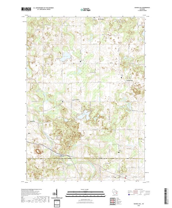
2022 Map of School Hill
USGS Topo · Published 2022About this map
Glacial geography defines this landscape on the border of Manitowoc and Sheboygan counties, where dozens of kettle lakes and sprawling wetlands pocket the terrain. The community of St. Nazianz occupies the northern edge, while the namesake School Hill and the settlement of Louis Corners serve as local anchors further south. Significant historical data for genealogists is found in the distribution of religious and community burial grounds, including the Society of the Divine Savior Cem, Holy Trinity Cem, and Union Cem. The Ice Age National Scenic Trl winds through the central portion of the map, tracing the moraine landscape past Cedar Lake and Sy Lake. In the southern reaches, the Sheboygan River and Millhome Cr converge near the hamlet of Millhome, while the Pigeon River flows toward the eastern boundary near Ada.
Find a feature on this map
70 named features on this map. Tap any name to fly to it.
Don’t see what you’re looking for? This feature index may not catch every label — zoom into the map to look around manually.
Map Details
Editions of this 2022 School Hill Map
This is the sole edition of this map. No revisions or reprints were ever made.
Other maps of this area

1954 · School Hill
USGS Topo · 1:24,000

1954 · St. Wendel
USGS Topo · 1:24,000

1954 · Howards Grove
USGS Topo · 1:62,500

1954 · Howards Grove
USGS Topo · 1:24,000

1954 · Chilton
USGS Topo · 1:62,500

1954 · Reedsville
USGS Topo · 1:62,500

1954 · Franklin
USGS Topo · 1:24,000

1954 · Kiel
USGS Topo · 1:62,500

1954 · Milwaukee
USGS Topo · 1:250,000

1954 · Manitowoc
USGS Topo · 1:250,000