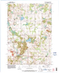
1992 Map of School Hill
USGS Topo · Published 1996About this map
Cedar Lake and a series of smaller kettle ponds dominate this Wisconsin landscape, where the Manitowoc and Sheboygan county line cuts through agricultural land and small rural hamlets. The area shows a high density of religious and community markers, notably the Salvatorian Seminary in the north and numerous burial grounds like Holy Trinity Cemetery near School Hill. The Sheboygan River winds through the southwestern corner, passing the small settlement of Millhome and its nearby Millhome Creek. This survey reflects the enduring post-war rural structure of the region, where tiny communities like Louis Corners, Rockville, and Ada serve as local anchors. Extensive Gravel Pits and various pits suggest the local importance of glacial aggregate resources to the regional economy alongside traditional dairy farming.
Find a feature on this map
37 named features on this map. Tap any name to fly to it.
Don’t see what you’re looking for? This feature index may not catch every label — zoom into the map to look around manually.
Map Details
Editions of this 1992 School Hill Map
This is the sole edition of this map. No revisions or reprints were ever made.
Other maps of this area

1954 · School Hill
USGS Topo · 1:24,000

1954 · St. Wendel
USGS Topo · 1:24,000

1954 · Howards Grove
USGS Topo · 1:62,500

1954 · Howards Grove
USGS Topo · 1:24,000

1954 · Chilton
USGS Topo · 1:62,500

1954 · Reedsville
USGS Topo · 1:62,500

1954 · Franklin
USGS Topo · 1:24,000

1954 · Kiel
USGS Topo · 1:62,500

1954 · Milwaukee
USGS Topo · 1:250,000

1954 · Manitowoc
USGS Topo · 1:250,000