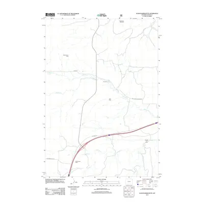
2012 Map of Schoolmarm Butte
USGS Topo · Published 2012About this map
Schoolmarm Butte and Sandstone Mountain anchor this landscape in northeastern Wyoming, where the drainage of Redwater Cr and its tributaries carve a network of draws and valleys. The ranching heritage of Crook County is evident in properties like Ripley Ranch and the broad expanse of Government Valley. This 2012 survey illustrates the modern transportation corridor where Old Highway 14 passes through the southern portion of the quadrangle. Water sources, vital for livestock and settlement in this semi-arid region, are meticulously mapped, including Stotts Spring and the winding paths of Alkali Cr and Sundance Cr. The map provides a detailed view of the terrain features such as Vore Draw and Crooked S Draw, which define the local topography between the various forks of the Redwater.
Find a feature on this map
17 named features on this map. Tap any name to fly to it.
Don’t see what you’re looking for? This feature index may not catch every label — zoom into the map to look around manually.
Map Details
Editions of this 2012 Schoolmarm Butte Map
This is the sole edition of this map. No revisions or reprints were ever made.
Other maps of this area

1898 · Sundance
USGS Topo · 1:125,000

1901 · Aladdin
USGS Topo · 1:125,000

1902 · Sundance
USGS Topo · 1:125,000

1903 · Aladdin
USGS Topo · 1:125,000

1954 · The Forks
USGS Topo · 1:24,000

1954 · Gillette
USGS Topo · 1:250,000

1955 · Gillette
USGS Topo · 1:250,000

1958 · Gillette
USGS Topo · 1:250,000

1958 · Beulah
USGS Topo · 1:62,500

1958 · Tinton
USGS Topo · 1:62,500