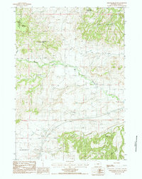
1984 Map of Schoolmarm Butte
USGS Topo · Published 1984About this map
Schoolmarm Butte rises as a prominent landmark in this section of northeastern Wyoming, situated near the western edge of the Black Hills National Forest. The landscape is defined by its complex drainage systems and varied elevations, featuring the dissected slopes of The Brakes and the flat-topped profiles of Table Mountain and Sandstone Mountain. Ranching history is evident at the Ripley Ranch, which sits near the junction of North Redwater Cr and other tributaries.
Find a feature on this map
19 named features on this map. Tap any name to fly to it.
Don’t see what you’re looking for? This feature index may not catch every label — zoom into the map to look around manually.
Map Details
Editions of this 1984 Schoolmarm Butte Map
This is the sole edition of this map. No revisions or reprints were ever made.
Other maps of this area

1898 · Sundance
USGS Topo · 1:125,000

1901 · Aladdin
USGS Topo · 1:125,000

1902 · Sundance
USGS Topo · 1:125,000

1903 · Aladdin
USGS Topo · 1:125,000

1954 · The Forks
USGS Topo · 1:24,000

1954 · Gillette
USGS Topo · 1:250,000

1955 · Gillette
USGS Topo · 1:250,000

1958 · Gillette
USGS Topo · 1:250,000

1958 · Beulah
USGS Topo · 1:62,500

1958 · Tinton
USGS Topo · 1:62,500