
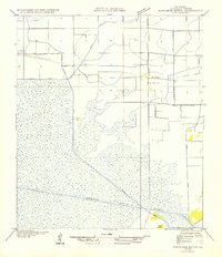
1946 Map of Schooner Bayou NW
USGS Topo · Published 1946About this map
Intracoastal Waterway dominates the lower half of this coastal landscape in Vermilion Parish, showing a transition between marshlands and organized agricultural irrigation. The map reveals an intricate network of man-made waterways including Spencer Canal and Robins Canal, which were critical for managing water in this low-lying region. Rural life in the mid-1930s (when field examinations were conducted) is anchored by the Marceaux Sch and local travel routes like State Highway No 516. Of particular interest to land historians is the Retracement of Previous Survey Line, illustrating the ongoing effort by the State of Louisiana Board of State Engineers to reconcile historical General Land Office records with the physical terrain. Grounded features like Pine Island and the Warren Trail provide specific coordinates for those tracing early 20th-century family movements and infrastructure.
Find a feature on this map
11 named features on this map. Tap any name to fly to it.
Don’t see what you’re looking for? This feature index may not catch every label — zoom into the map to look around manually.
Map Details
Editions of this 1946 Schooner Bayou NW Map
This is the sole edition of this map. No revisions or reprints were ever made.
Other maps of this area

1946 · Morse
USGS Topo · 1:31,680

1946 · Schooner Bayou SE
USGS Topo · 1:31,680

1946 · Schooner Bayou NE
USGS Topo · 1:31,680

1946 · Kaplan
USGS Topo · 1:31,680

1946 · Schooner Bayou SW
USGS Topo · 1:31,680

1949 · Gueydan
USGS Topo · 1:31,680

1952 · Lake Charles
USGS Topo · 1:250,000

1953 · Jacks Point Island
USGS Topo · 1:24,000

1954 · Grand Lake East SE
USGS Topo · 1:31,680
1954 · Schooner Bayou NW
USGS Topo · 1:31,680