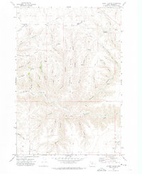
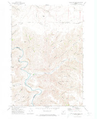
1970 Map of Schott Canyon
USGS Topo · Published 1973About this map
Cameron School stands as a primary point of local history on this high plateau of north-central Oregon. The landscape is defined by a dense network of drainages and ridges, where the upland cattle and wheat country is carved by deep draws such as Schott Canyon and Sunshine Canyon. These geographic features often bear descriptive names like Shoestring Ridge, Yellow Dog Canyon, and Coyote Butte. Settlement is sparse, represented by isolated landmarks such as Linville 3 and scattered agricultural infrastructure including a Grain Elevator Storage Bin and various Storage Bins.
Find a feature on this map
41 named features on this map. Tap any name to fly to it.
Don’t see what you’re looking for? This feature index may not catch every label — zoom into the map to look around manually.
Map Details
Editions of this 1970 Schott Canyon Map
This is the sole edition of this map. No revisions or reprints were ever made.
Other maps of this area

1916 · Condon
USGS Topo · 1:125,000

1953 · The Dalles
USGS Topo · 1:250,000

1956 · The Dalles
USGS Topo · 1:250,000

1957 · The Dalles
USGS Topo · 1:250,000

1970 · Igo Butte
USGS Topo · 1:24,000
1970 · Chimney Springs
USGS Topo · 1:24,000

1970 · Condon
USGS Topo · 1:24,000
1970 · Buckhorn Canyon
USGS Topo · 1:24,000
1970 · Fossil North
USGS Topo · 1:24,000
1970 · Shoestring Ridge
USGS Topo · 1:24,000