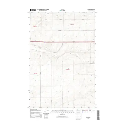
2013 Map of Schrag
USGS Topo · Published 2013About this map
Schrag serves as the central focal point of this agricultural landscape in Adams County, where the high plateau is carved by the distinct drainage patterns of Farrier Coulee and Bauer Coulee. The map illustrates a rigid grid of section-line roads, such as N Batum Rd and N Roxboro Rd, which facilitate transport across the expansive grain-farming region. The transportation network is anchored by a major interstate corridor running east-west, providing a sharp contrast to the local rural routes like W Schrag Rd. Aviation history in the area is represented by the Franz Ranch Airport, situated south of the main settlement near N Kulm Rd. This 2013 survey provides a detailed look at the interface between traditional dryland farming layouts and modern transportation infrastructure.
Find a feature on this map
22 named features on this map. Tap any name to fly to it.
Don’t see what you’re looking for? This feature index may not catch every label — zoom into the map to look around manually.
Map Details
Editions of this 2013 Schrag Map
This is the sole edition of this map. No revisions or reprints were ever made.
Other maps of this area

1916 · Connell
USGS Topo · 1:125,000

1918 · Connell
USGS Topo · 1:125,000

1925 · Schrag
USGS Topo · 1:62,500

1953 · Walla Walla
USGS Topo · 1:250,000

1953 · Ritzville
USGS Topo · 1:250,000

1958 · Walla Walla
USGS Topo · 1:250,000

1959 · Ritzville
USGS Topo · 1:250,000

1965 · Ritzville
USGS Topo · 1:250,000

1967 · Reiman SW
USGS Topo · 1:24,000
1967 · Ruff
USGS Topo · 1:24,000