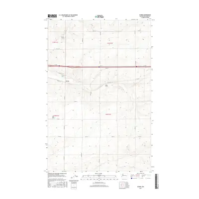
2017 Map of Schrag
USGS Topo · Published 2017About this map
Schrag and the surrounding plateau of Adams County are defined by a series of glacial drainage features, most notably the winding path of Bauer Coulee. This landscape illustrates the characteristic geology of the Channeled Scablands, where ancient floods carved deep depressions into the basalt. In the early 21st century, the area remains dominated by large-scale agricultural parcels and a geometric grid of rural roads, including W Schrag Rd and Koch Rd, which intersect with the major regional thoroughfare crossing the northern half of the territory. The map provides a precise look at the township and range system, showing how section lines and property boundaries have been superimposed over the irregular natural topography of the coulee systems.
Find a feature on this map
2 named features on this map. Tap any name to fly to it.
Don’t see what you’re looking for? This feature index may not catch every label — zoom into the map to look around manually.
Map Details
Editions of this 2017 Schrag Map
This is the sole edition of this map. No revisions or reprints were ever made.
Other maps of this area

1916 · Connell
USGS Topo · 1:125,000

1918 · Connell
USGS Topo · 1:125,000

1925 · Schrag
USGS Topo · 1:62,500

1953 · Walla Walla
USGS Topo · 1:250,000

1953 · Ritzville
USGS Topo · 1:250,000

1958 · Walla Walla
USGS Topo · 1:250,000

1959 · Ritzville
USGS Topo · 1:250,000

1965 · Ritzville
USGS Topo · 1:250,000

1967 · Reiman SW
USGS Topo · 1:24,000
1967 · Ruff
USGS Topo · 1:24,000