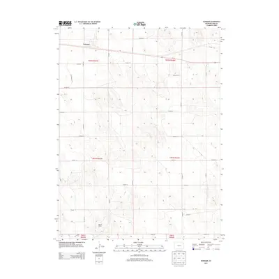
2013 Map of Schramm
USGS Topo · Published 2013About this map
Schramm and the surrounding agricultural lands of Yuma County are defined by a strict section-line grid that organizes the High Plains landscape. In this 2013 survey, Us-34 E cuts across the northern third of the territory, serving as the primary arterial link through the region. The map reveals the systematic development of rural infrastructure, where named routes like CO Road M, CO Road N, and CO Road 30 create a predictable framework for land management and transport. Cultural features are concentrated around local enterprises and landmarks, such as Triple R Farms and the topographic prominence of Mount Yuma in the southern portion of the quadrangle. This detailed rendering of the Public Land Survey System provides a clear record of property boundaries and the enduring structure of the Colorado plains at the start of the twenty-first century.
Find a feature on this map
29 named features on this map. Tap any name to fly to it.
Don’t see what you’re looking for? This feature index may not catch every label — zoom into the map to look around manually.
Map Details
Editions of this 2013 Schramm Map
This is the sole edition of this map. No revisions or reprints were ever made.
Other maps of this area

1954 · Limon
USGS Topo · 1:250,000

1954 · Sterling
USGS Topo · 1:250,000

1957 · Limon
USGS Topo · 1:250,000

1958 · Limon
USGS Topo · 1:250,000

1958 · Sterling
USGS Topo · 1:250,000

1961 · Eckley
USGS Topo · 1:24,000

1969 · Heartstrong
USGS Topo · 1:24,000

1969 · Vernon NW
USGS Topo · 1:24,000

1969 · Schramm
USGS Topo · 1:24,000

1971 · Yuma NE
USGS Topo · 1:24,000