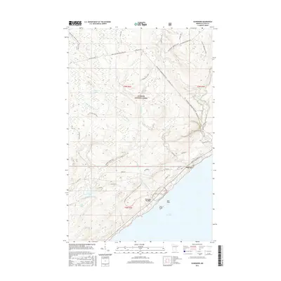
2016 Map of Schroeder
USGS Topo · Published 2016About this map
Schroeder and the industrial infrastructure of Taconite Harbor anchor this coastal survey along the North Shore. The settlement pattern is defined by the sharp transition from the rocky coastline of Lake Superior to the dense woods of the Superior National Forest. While Minnesota Highway 61 and Cramer Rd provide the primary vehicular arteries, the landscape is deeply etched with recreational and wilderness corridors. The Superior Hiking Trail and the N Shore State Trail wind through the inland topography, crossing numerous waterways like the Two Island River and the Cross River. Small inland water bodies such as Dyers Lake and Richey Lake are scattered throughout the northern reaches, while the Schroeder Cem remains a primary landmark for local genealogy and history near the river mouth.
Find a feature on this map
34 named features on this map. Tap any name to fly to it.
Don’t see what you’re looking for? This feature index may not catch every label — zoom into the map to look around manually.
Map Details
Editions of this 2016 Schroeder Map
This is the sole edition of this map. No revisions or reprints were ever made.
Other maps of this area

1954 · Two Harbors
USGS Topo · 1:250,000

1955 · Tofte
USGS Topo · 1:24,000

1955 · Schroeder
USGS Topo · 1:24,000

1955 · Tofte
USGS Topo · 1:62,500

1955 · Cramer
USGS Topo · 1:62,500

1956 · Little Marais
USGS Topo · 1:24,000

1956 · Finland
USGS Topo · 1:62,500

1957 · Two Harbors
USGS Topo · 1:250,000

1958 · Two Harbors
USGS Topo · 1:250,000

1964 · Two Harbors
USGS Topo · 1:250,000