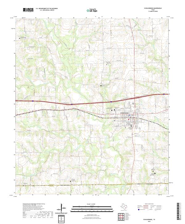
2022 Map of Schulenburg
USGS Topo · Published 2022About this map
Schulenburg serves as the central hub of this South Texas landscape, situated just north of the Fayette Co and Lavaca Co boundary line. The area is defined by a dense network of country roads and family-named routes like Freyburg Hall Rd and W Blaschke Rd, which connect numerous rural burial grounds and parish sites. The distribution of these sites, including the Old High Hill Cem and Saint Marys Catholic Cem, reflects the deep-rooted settlement patterns of the German and Czech communities that populated the region.
Find a feature on this map
119 named features on this map. Tap any name to fly to it.
Don’t see what you’re looking for? This feature index may not catch every label — zoom into the map to look around manually.
Map Details
Editions of this 2022 Schulenburg Map
This is the sole edition of this map. No revisions or reprints were ever made.
Other maps of this area

1901 · Flatonia
USGS Topo · 1:125,000

1919 · Schulenburg
USGS Topo · 1:62,500

1953 · Seguin
USGS Topo · 1:250,000

1956 · La Grange
USGS Topo · 1:62,500

1957 · Ammannsville
USGS Topo · 1:24,000

1958 · Seguin
USGS Topo · 1:250,000

1965 · Oakland
USGS Topo · 1:24,000

1965 · Muldoon
USGS Topo · 1:24,000
1965 · Weimar
USGS Topo · 1:24,000

1965 · Schulenburg
USGS Topo · 1:24,000