1965 Map of Schulenburg
USGS Topo · Published 1967About this map
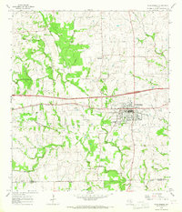
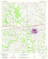
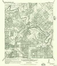
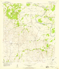
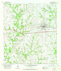
Schulenburg dominates the landscape as a vital rail hub in the mid-1960s, defined by the Southern Pacific tracks that bisect the town. The settlement patterns reveal a transition from traditional rural communities to modern town life, with the Drive-in Theater and Kehrer Park providing recreational space for the growing population. Beyond the town limits, the topography is carved by a dense network of waterways, including the West Navidad River, Bee Creek, and Brusky Creek, which drain the undulating terrain of the Fayette and Lavaca county border.
Find a feature on this map
34 named features on this map. Tap any name to fly to it.
Don’t see what you’re looking for? This feature index may not catch every label — zoom into the map to look around manually.
Map Details
Editions of this 1965 Schulenburg Map
2 editions found
Other maps of this area
1901 · Flatonia
USGS Topo · 1:125,000
1919 · Schulenburg
USGS Topo · 1:62,500

1953 · Seguin
USGS Topo · 1:250,000
1956 · La Grange
USGS Topo · 1:62,500
1957 · Ammannsville
USGS Topo · 1:24,000

1958 · Seguin
USGS Topo · 1:250,000
1965 · Oakland
USGS Topo · 1:24,000
1965 · Muldoon
USGS Topo · 1:24,000
1965 · Weimar
USGS Topo · 1:24,000
1965 · Swiss Alp
USGS Topo · 1:24,000