
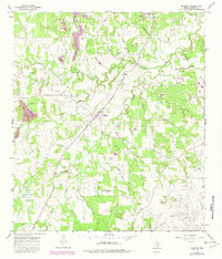
1965 Map of Muldoon
USGS Topo · Published 1967About this map
Muldoon serves as a central hub in Fayette County during the mid-1960s, defined by the diagonal passage of the Southern Pacific railroad. The landscape is a patchwork of wooded creek bottoms and cleared fields, where the local economy transitions from traditional agriculture toward resource extraction. The presence of Muldoon Field and a scattered Strip Mine and Gravel Pit indicate an active industrial layer atop the rural terrain. Genealogy researchers will find several localized landmarks, including the Pitman Cem and Black Jack Springs Cem, which anchor the small settlements of Floy and Marly. Distinctive features such as a Charcoal Oven and a small Landing Area north of Live Oak Creek offer specific insights into the land use patterns and small-scale infrastructure of the period, while numerous waterways like Buckners Creek and Pin Oak Creek define the area's natural drainage.
Find a feature on this map
24 named features on this map. Tap any name to fly to it.
Don’t see what you’re looking for? This feature index may not catch every label — zoom into the map to look around manually.
Map Details
Editions of this 1965 Muldoon Map
2 editions found
Other maps of this area

1901 · Flatonia
USGS Topo · 1:125,000

1919 · Schulenburg
USGS Topo · 1:62,500

1953 · Seguin
USGS Topo · 1:250,000

1956 · La Grange
USGS Topo · 1:62,500

1958 · La Grange West
USGS Topo · 1:24,000
1958 · West Point
USGS Topo · 1:24,000

1958 · Seguin
USGS Topo · 1:250,000
1964 · Togo
USGS Topo · 1:24,000

1965 · Schulenburg
USGS Topo · 1:24,000

1965 · Cistern
USGS Topo · 1:24,000