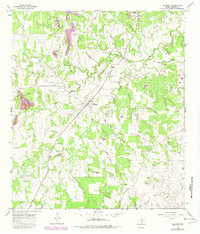
1965 Map of Muldoon
USGS Topo · Published 1982About this map
Muldoon serves as the central hub of this Fayette County survey, situated along the Southern Pacific railroad line. The landscape is a complex mix of agricultural drainage and resource extraction, characterized by the Muldoon Oil Field and scattered industrial activity including a Charcoal Oven and several Strip Mines. The rural character of the mid-1960s is preserved through the mapping of small settlements like Marly and local landmarks such as a Landing Area and a Gravel Pit.
Find a feature on this map
25 named features on this map. Tap any name to fly to it.
Don’t see what you’re looking for? This feature index may not catch every label — zoom into the map to look around manually.
Map Details
Editions of this 1965 Muldoon Map
2 editions found
Other maps of this area

1901 · Flatonia
USGS Topo · 1:125,000

1919 · Schulenburg
USGS Topo · 1:62,500

1953 · Seguin
USGS Topo · 1:250,000

1956 · La Grange
USGS Topo · 1:62,500

1958 · La Grange West
USGS Topo · 1:24,000
1958 · West Point
USGS Topo · 1:24,000

1958 · Seguin
USGS Topo · 1:250,000
1964 · Togo
USGS Topo · 1:24,000

1965 · Muldoon
USGS Topo · 1:24,000

1965 · Schulenburg
USGS Topo · 1:24,000