1969 Map of Scio
USGS Topo · Published 1987About this map
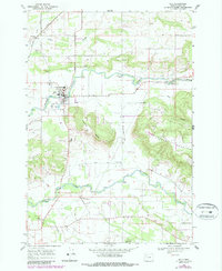
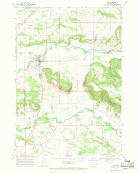
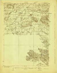
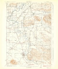
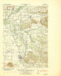
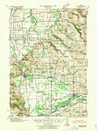
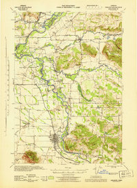
Thomas Creek and Crabtree Creek define the agricultural landscape of this Linn County region, which was captured during a 1969 field check and updated in the mid-1980s. The town of Scio serves as a central hub, where the local High Sch and infrastructure like the Sewage Disposal Ponds contrast with the surrounding valley floor. The map highlights a transition from flat farmland to the higher elevations of Rogers Mountain and Hungry Hill, showing how early drainage efforts like Peters Ditch shaped the land for cultivation.
Find a feature on this map
32 named features on this map. Tap any name to fly to it.
Don’t see what you’re looking for? This feature index may not catch every label — zoom into the map to look around manually.
Map Details
Editions of this 1969 Scio Map
2 editions found
Other maps of this area
1911 · Lebanon
USGS Topo · 1:31,680
1921 · Lebanon
USGS Topo · 1:62,500
1922 · Lebanon
USGS Topo · 1:48,000
1924 · Lebanon
USGS Topo · 1:62,500

1925 · Stayton
USGS Topo · 1:62,500
1940 · Lebanon
USGS Topo · 1:62,500
1941 · Stayton
USGS Topo · 1:62,500
1944 · Lebanon
USGS Topo · 1:62,500
1951 · Lyons
USGS Topo · 1:62,500
1951 · Snow Peak
USGS Topo · 1:62,500