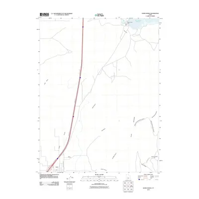
2010 Map of Scipio North
USGS Topo · Published 2010About this map
Scipio anchors the southern portion of this landscape, its grid of streets such as N State St and N 200 E extending into the Scipio Valley. The town's historical geography is marked by the Scipio Cemetery situated just north of the residential center along the Frontage Rd. To the northeast, the Sevier River is impounded to form the Sevier Bridge Reservoir, a significant water feature regulated by the Sevier Bridge Dam and Yuba Dam. This topography transitions from the alluvial floor of Round Valley Creek into a complex system of drainages and named formations. The eastern Mountains are deeply etched by features like Painted Rock Canyon and the wide expanse of Dick and Dalton Flat, while the central valley floor is punctuated by the long reach of Jakes Canyon. The map reveals a high-desert environment where infrastructure like Chris Hollow Rd provides access to remote reaches such as Chriss Hollow.
Find a feature on this map
25 named features on this map. Tap any name to fly to it.
Don’t see what you’re looking for? This feature index may not catch every label — zoom into the map to look around manually.
Map Details
Editions of this 2010 Scipio North Map
This is the sole edition of this map. No revisions or reprints were ever made.
Other maps of this area

1885 · Manti
USGS Topo · 1:250,000

1885 · Sevier Desert
USGS Topo · 1:250,000

1895 · Manti
USGS Topo · 1:250,000

1952 · Scipio North
USGS Topo · 1:62,500

1953 · Delta
USGS Topo · 1:250,000

1956 · Price
USGS Topo · 1:250,000

1958 · Delta
USGS Topo · 1:250,000

1960 · Price
USGS Topo · 1:250,000

1962 · Price
USGS Topo · 1:250,000

1962 · Delta
USGS Topo · 1:250,000