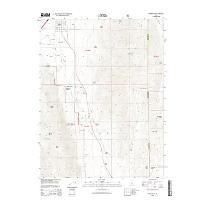
2014 Map of Scipio South
USGS Topo · Published 2014About this map
The town of Scipio serves as the focal point for this survey, situated at the northern edge of the Scipio Valley. The landscape is defined by the dramatic meeting of the Valley Mountains to the east and the Pahvant Range to the west, with much of the southwestern quadrant protected within the Fishlake National Forest. This mapping effort records the complex network of drainage and topography that funnels through the area, including the winding course of Round Valley Cr and named landmarks like Indian Knoll and Noon Rock Peak. High-altitude features such as Lone Cedar Pass and Wills Hole provide specific geographic markers for those navigating the steep terrain between the valleys. The presence of Upper Ebbs Spring and Ralph Land Spring indicates the critical water sources that supported livestock and settlement in this arid high-desert environment of central Utah.
Find a feature on this map
42 named features on this map. Tap any name to fly to it.
Don’t see what you’re looking for? This feature index may not catch every label — zoom into the map to look around manually.
Map Details
Editions of this 2014 Scipio South Map
This is the sole edition of this map. No revisions or reprints were ever made.
Other maps of this area

1885 · Manti
USGS Topo · 1:250,000

1885 · Sevier Desert
USGS Topo · 1:250,000

1895 · Manti
USGS Topo · 1:250,000

1952 · Scipio North
USGS Topo · 1:62,500

1953 · Delta
USGS Topo · 1:250,000

1956 · Price
USGS Topo · 1:250,000

1958 · Delta
USGS Topo · 1:250,000

1960 · Price
USGS Topo · 1:250,000

1962 · Price
USGS Topo · 1:250,000

1962 · Delta
USGS Topo · 1:250,000