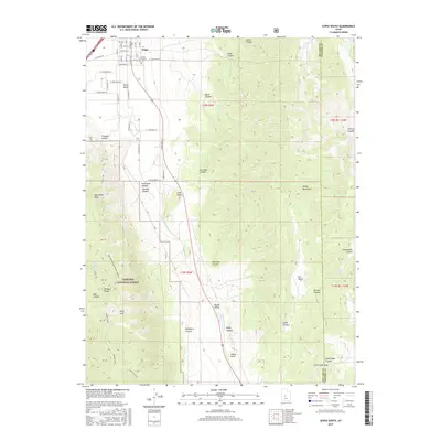
2017 Map of Scipio South
USGS Topo · Published 2017About this map
The town of Scipio sits at the northern edge of this 2017 study, where the gridded streets of the settlement meet the open expanse of Scipio Valley. This landscape is defined by the high elevations of the Pahvant Range to the west and the Valley Mountains to the east, creating a corridor of high-desert basins. Local history is anchored at the Scipio Pioneer Cem, while the surrounding terrain is marked by numerous named drainages such as Sawmill Canyon and Klondike Canyon. The map records a complex network of forest roads and trails within the Fishlake National Forest, including the Ebbs Canyon-Noon Rock-Graball route. Significant landmarks like Noon Rock Peak and Indian Knoll punctuate the ridges, overseeing the transition from the cultivated valley floor to the timbered slopes of the national forest.
Find a feature on this map
72 named features on this map. Tap any name to fly to it.
Don’t see what you’re looking for? This feature index may not catch every label — zoom into the map to look around manually.
Map Details
Editions of this 2017 Scipio South Map
This is the sole edition of this map. No revisions or reprints were ever made.
Other maps of this area

1885 · Manti
USGS Topo · 1:250,000

1885 · Sevier Desert
USGS Topo · 1:250,000

1895 · Manti
USGS Topo · 1:250,000

1952 · Scipio North
USGS Topo · 1:62,500

1953 · Delta
USGS Topo · 1:250,000

1956 · Price
USGS Topo · 1:250,000

1958 · Delta
USGS Topo · 1:250,000

1960 · Price
USGS Topo · 1:250,000

1962 · Price
USGS Topo · 1:250,000

1962 · Delta
USGS Topo · 1:250,000