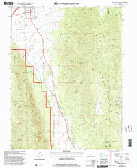
2001 Map of Scipio South
USGS Topo · Published 2003About this map
Scipio anchors the northwest corner of this transition from high desert valley to the high ridges of the Fish Lake National Forest. The landscape is dominated by the broad, arid expanse of Scipio Valley and Round Valley, where natural water sources like Upper Echo Spring and Ralph Lund Spring were essential for early grazing and settlement. The mapping reveals a rugged eastern wall of canyons, including Sorensen Canyon and Klondike Canyon, that separate the valley floor from the high peaks of the mountain range to the east.
Find a feature on this map
39 named features on this map. Tap any name to fly to it.
Don’t see what you’re looking for? This feature index may not catch every label — zoom into the map to look around manually.
Map Details
Editions of this 2001 Scipio South Map
This is the sole edition of this map. No revisions or reprints were ever made.
Other maps of this area

1885 · Manti
USGS Topo · 1:250,000

1885 · Sevier Desert
USGS Topo · 1:250,000

1895 · Manti
USGS Topo · 1:250,000

1952 · Scipio North
USGS Topo · 1:62,500

1953 · Delta
USGS Topo · 1:250,000

1956 · Price
USGS Topo · 1:250,000

1958 · Delta
USGS Topo · 1:250,000

1960 · Price
USGS Topo · 1:250,000

1962 · Price
USGS Topo · 1:250,000

1962 · Delta
USGS Topo · 1:250,000