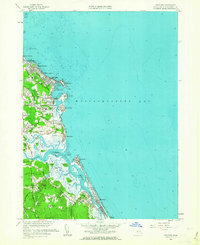
1961 Map of Scituate
USGS Topo · Published 1963About this map
Scituate Harbor and its surrounding coastal settlements dominate this early 1960s survey of the Plymouth County shoreline. The map documents a landscape defined by its relation to the sea, where established villages like Greenbush and Marshfield Hills sit inland while newer developments such as Shore Acres and Sand Hills line the coast. Military and navigational installations are prominent, including the USAF Res radio towers at Fourth Cliff and the Coast Guard Station near Cedar Point. The intricate drainage of the North River and South River creates a complex network of marshlands and named islands like Trouant Island and Tilden Island. Genealogists will find significant detail in the inclusion of the Meeting House Lane Cemetery and Church, James Cem, and the path of the New York New Haven and Hartford railroad line, reflecting the area's long-standing infrastructure.
Find a feature on this map
66 named features on this map. Tap any name to fly to it.
Don’t see what you’re looking for? This feature index may not catch every label — zoom into the map to look around manually.
Map Details
Editions of this 1961 Scituate Map
2 editions found
Other maps of this area

1885 · Abington
USGS Topo · 1:62,500

1885 · Duxbury
USGS Topo · 1:62,500

1888 · Duxbury
USGS Topo · 1:62,500

1888 · Abington
USGS Topo · 1:62,500

1892 · Boston Bay
USGS Topo · 1:62,500

1893 · Abington
USGS Topo · 1:62,500

1893 · Duxbury
USGS Topo · 1:62,500

1903 · Boston Bay
USGS Topo · 1:62,500

1918 · Duxbury
USGS Topo · 1:62,500

1920 · Abington
USGS Topo · 1:62,500