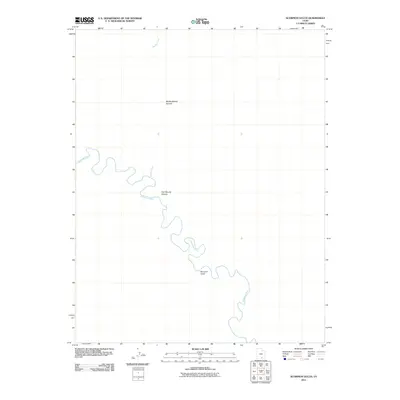
2011 Map of Scorpion Gulch
USGS Topo · Published 2011About this map
The Escalante River carves a complex, winding path through this corner of Southern Utah, defining the primary drainage for a landscape shaped by ancient water action. As it meanders southeast, it is joined by Moody Creek, a tributary that drains the northern reaches of the quadrangle. The topography is dominated by dramatic canyon systems, including the deeply etched profiles of Middle Moody Canyon and East Moody Canyon, which converge toward the river valley. Further south, the namesake Scorpion Gulch provides a narrow passage through the high desert terrain. This 2011 survey illustrates a region where the natural geology remains the primary feature, with no roads or settlements interrupting the intricate network of canyons and riparian corridors that characterize the Escalante basin.
Find a feature on this map
5 named features on this map. Tap any name to fly to it.
Don’t see what you’re looking for? This feature index may not catch every label — zoom into the map to look around manually.
Map Details
Editions of this 2011 Scorpion Gulch Map
This is the sole edition of this map. No revisions or reprints were ever made.
Other maps of this area

1886 · Escalante
USGS Topo · 1:250,000

1886 · Henry Mountains
USGS Topo · 1:250,000

1892 · Henry Mountains
USGS Topo · 1:250,000

1953 · Circle Cliffs 4 NW
USGS Topo · 1:24,000

1953 · Mt Pennell 3 NW
USGS Topo · 1:24,000

1953 · Mt Pennell 3 SW
USGS Topo · 1:24,000

1953 · Circle Cliffs 4 NE
USGS Topo · 1:24,000

1953 · Circle Cliffs 4 SW
USGS Topo · 1:24,000

1953 · The Rincon
USGS Topo · 1:62,500

1953 · Hall Mesa
USGS Topo · 1:62,500