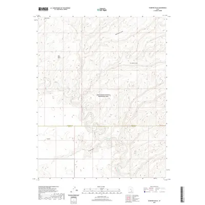
2020 Map of Scorpion Gulch
USGS Topo · Published 2020About this map
The Escalante River carves a deep, winding path through the center of this 2020 landscape, marking a significant hydrological artery within the Glen Canyon National Recreation Area. The terrain is defined by dramatic elevation changes, characterized by high plateaus like Baker Bench and East Baker Bench that drop sharply into complex drainage systems. To the north, the topography is fractured by the deep incisions of Middle Moody Canyon and East Moody Canyon, while the southern portion is dominated by the namesake Scorpion Gulch. This map illustrates the intersection of Garfield and Kane counties in a region almost entirely devoid of modern infrastructure, where the natural course of Moody Cr and the sheer verticality of the canyon walls dictate the movement of the land.
Find a feature on this map
10 named features on this map. Tap any name to fly to it.
Don’t see what you’re looking for? This feature index may not catch every label — zoom into the map to look around manually.
Map Details
Editions of this 2020 Scorpion Gulch Map
This is the sole edition of this map. No revisions or reprints were ever made.
Other maps of this area

1886 · Escalante
USGS Topo · 1:250,000

1886 · Henry Mountains
USGS Topo · 1:250,000

1892 · Henry Mountains
USGS Topo · 1:250,000

1953 · Circle Cliffs 4 NW
USGS Topo · 1:24,000

1953 · Mt Pennell 3 NW
USGS Topo · 1:24,000

1953 · Mt Pennell 3 SW
USGS Topo · 1:24,000

1953 · Circle Cliffs 4 NE
USGS Topo · 1:24,000

1953 · Circle Cliffs 4 SW
USGS Topo · 1:24,000

1953 · The Rincon
USGS Topo · 1:62,500

1953 · Hall Mesa
USGS Topo · 1:62,500