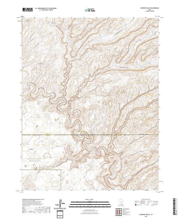
2023 Map of Scorpion Gulch
USGS Topo · Published 2023About this map
The Escalante River winds through a deeply incised canyon landscape in this modern topographic survey, marking the primary drainage for a region of complex high-desert topography. The map illustrates the southern reaches of Garfield County and its boundary with Kane County, where much of the terrain is managed as part of the Glen Canyon National Recreation Area. These public lands are defined by massive geological benches and erosion-carved drainages, most notably the namesake Scorpion Gulch in the southern portion of the quadrangle.
Find a feature on this map
9 named features on this map. Tap any name to fly to it.
Don’t see what you’re looking for? This feature index may not catch every label — zoom into the map to look around manually.
Map Details
Editions of this 2023 Scorpion Gulch Map
This is the sole edition of this map. No revisions or reprints were ever made.
Other maps of this area

1886 · Escalante
USGS Topo · 1:250,000

1886 · Henry Mountains
USGS Topo · 1:250,000

1892 · Henry Mountains
USGS Topo · 1:250,000

1953 · Circle Cliffs 4 NW
USGS Topo · 1:24,000

1953 · Mt Pennell 3 NW
USGS Topo · 1:24,000

1953 · Mt Pennell 3 SW
USGS Topo · 1:24,000

1953 · Circle Cliffs 4 NE
USGS Topo · 1:24,000

1953 · Circle Cliffs 4 SW
USGS Topo · 1:24,000

1953 · The Rincon
USGS Topo · 1:62,500

1953 · Hall Mesa
USGS Topo · 1:62,500