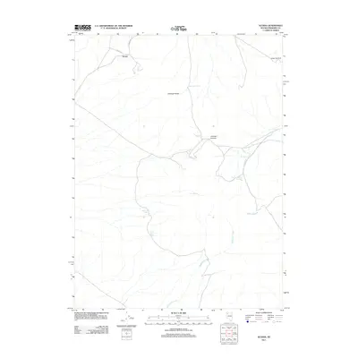
2011 Map of Scossa
USGS Topo · Published 2011About this map
Scossa sits at the northern edge of this high-desert terrain, where the topography is defined by the Antelope Range and its various water sources. In a region where reliable water dictated survival and travel, the map identifies numerous specific points such as Moonshine Spring, Cedar Springs, and Abel Camp Spring. These locations often served as critical nodes for early ranching and prospecting in Pershing County. The drainage of Rabbithole Creek carves through the southern landscape, while Pioneer Rd and Scossa Rd provide the primary historical access through the mountain passes. The concentration of named springs like Little Antelope Spring and Willow Springs suggests a landscape where small-scale human activity was tethered to these infrequent hydrologic features. The map also documents significant elevation points, including Imlay Summit and Antelope Summit, which mark the divide between the desert flats and the higher ridgelines.
Find a feature on this map
14 named features on this map. Tap any name to fly to it.
Don’t see what you’re looking for? This feature index may not catch every label — zoom into the map to look around manually.
Map Details
Editions of this 2011 Scossa Map
This is the sole edition of this map. No revisions or reprints were ever made.
Other maps of this area

1931 · Lovelock
USGS Topo · 1:250,000

1935 · Lovelock
USGS Topo · 1:250,000

1955 · Lovelock
USGS Topo · 1:250,000

1959 · Lovelock
USGS Topo · 1:250,000

1971 · Majuba Mtn
USGS Topo · 1:24,000

1971 · Poker Brown
USGS Topo · 1:24,000
1971 · Long Canyon
USGS Topo · 1:24,000
1981 · Sawtooth Knob
USGS Topo · 1:24,000

1981 · Scossa
USGS Topo · 1:24,000

1981 · Placerites
USGS Topo · 1:24,000