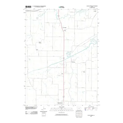
2010 Map of Scotch Ridge
USGS Topo · Published 2010About this map
North River and the Middle River converge near the heart of this Warren County landscape, creating a rich network of drainage including Plug Run and Butcher Creek. The northern edge of Indianola transitions into rural acreage, where family names are preserved at the Laverty Cemetery and North River Cemetery. Local aviation history is grounded at the Loerke-Fox Run Aerodrome and Laverty Field, while the small community of Scotch Ridge remains a distinct landmark north of Summerset. The settlement patterns here follow a grid of established roads such as Scotch Ridge Rd and Summerset Rd, reflecting the agricultural character of central Iowa in the early twenty-first century.
Find a feature on this map
37 named features on this map. Tap any name to fly to it.
Don’t see what you’re looking for? This feature index may not catch every label — zoom into the map to look around manually.
Map Details
Editions of this 2010 Scotch Ridge Map
This is the sole edition of this map. No revisions or reprints were ever made.
Other maps of this area

1905 · Des Moines
USGS Topo · 1:62,500

1907 · Des Moines
USGS Topo · 1:62,500

1910 · Milo
USGS Topo · 1:62,500

1930 · Mitchellville
USGS Topo · 1:62,500

1931 · Indianola
USGS Topo · 1:62,500

1954 · Des Moines
USGS Topo · 1:250,000

1956 · Des Moines
USGS Topo · 1:250,000

1956 · Des Moines SW
USGS Topo · 1:24,000

1956 · Des Moines SE
USGS Topo · 1:24,000

1956 · Des Moines
USGS Topo · 1:62,500